
Bluberri · Operational intelligence · Mining · Defense & critical infrastructure
Multiple sources. One operational picture.
Connect systems, sensors and field reports into one shared picture, with alerts and traceability.
-
01 / 03 · The data exists
The data exists. It lives scattered.
A field report, a connected sensor, each system's own console, a satellite pass.
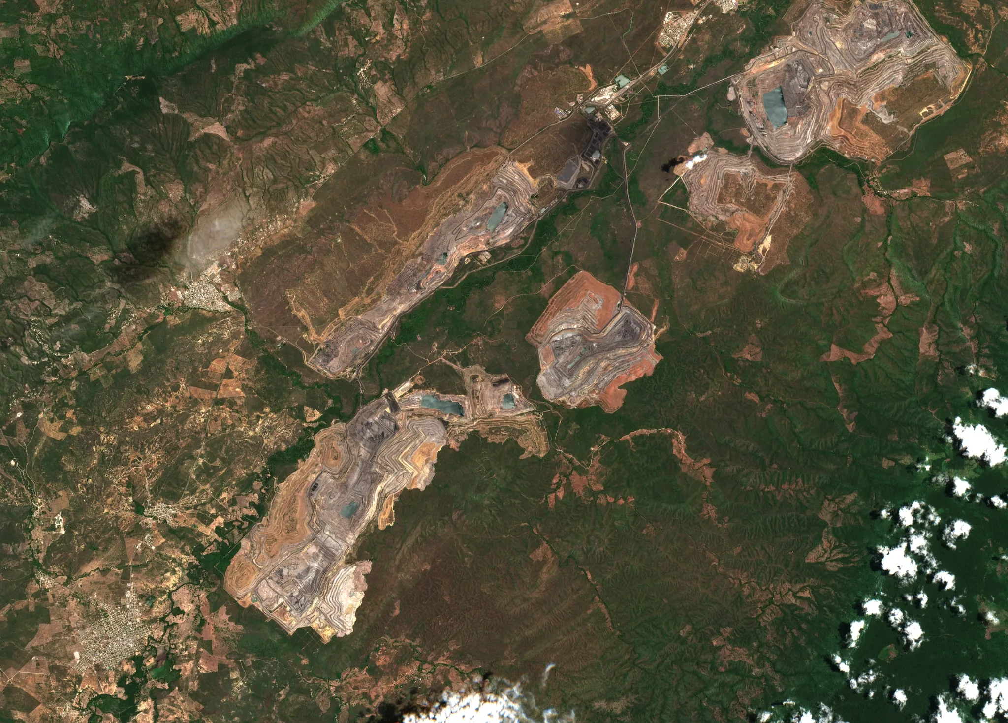
True color · Sentinel-2 · 10 m per pixel
-
02 / 03 · Bluberri joins it
Bluberri joins it.
Nine entities translate every source into one language.
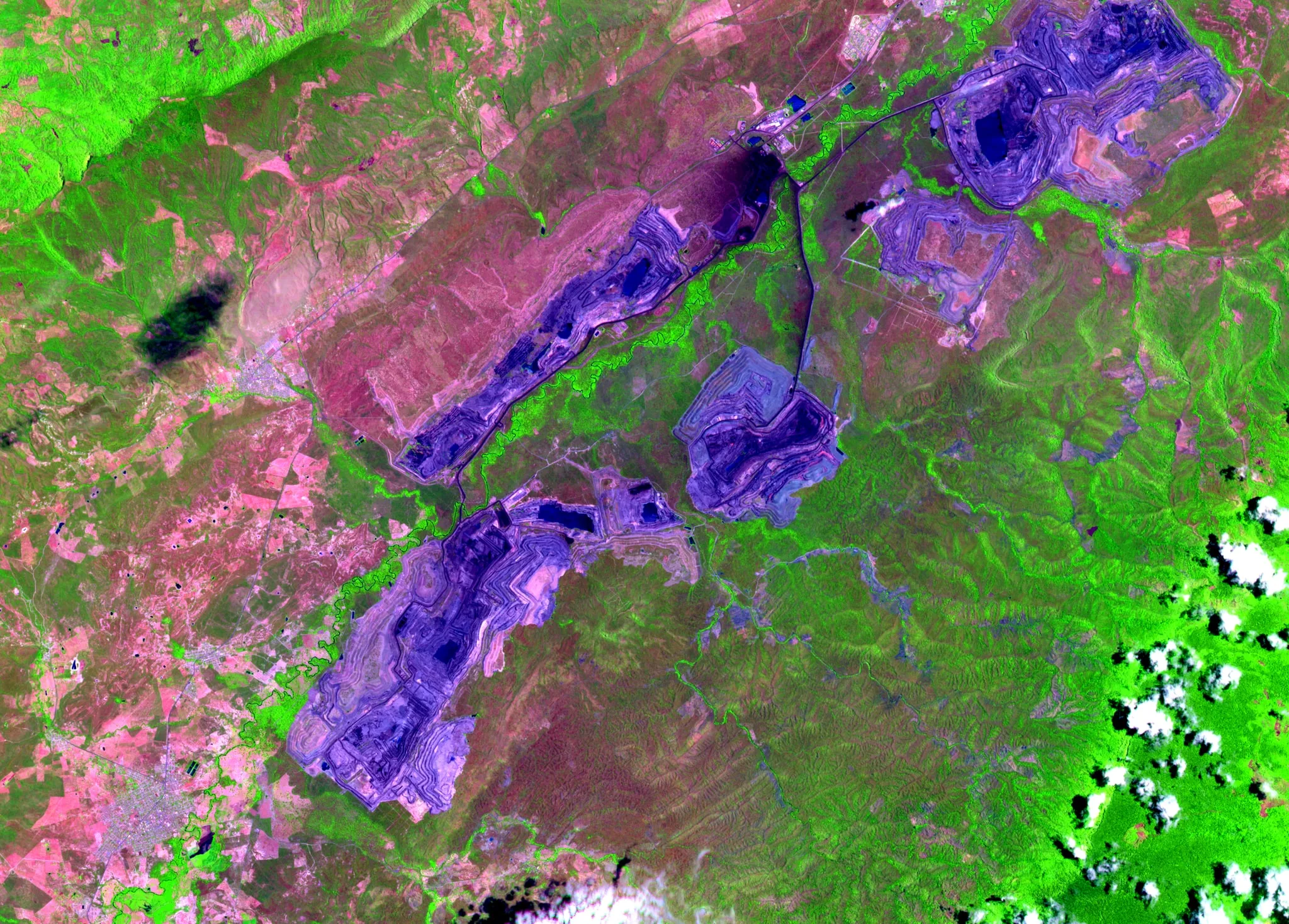
SWIR · NIR · red: three bands the eye cannot see, in a single image
-
03 / 03 · Alerts with evidence
Alerts with evidence.
An explicit rule turns the signal into a finding; the finding carries an owner, a deadline and proof of closure.
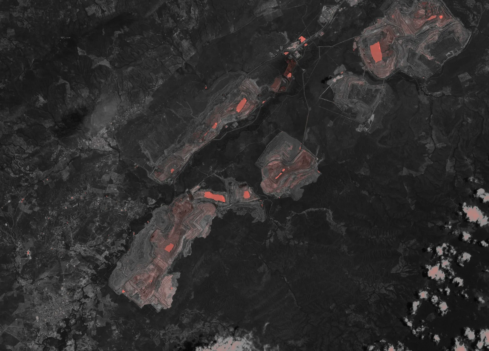
NDWI (B03 / B08): surface water and moisture in coral · illustrative markers


Shared data model
What does it look like?
It starts with an inventory of information sources to cross-check, analyze and decide on.
We hook in where the data is already structured. The manufacturer remains responsible for its hardware.
-
Coal pits, La Guajira, Colombia · True colour · 08/10/2026 -
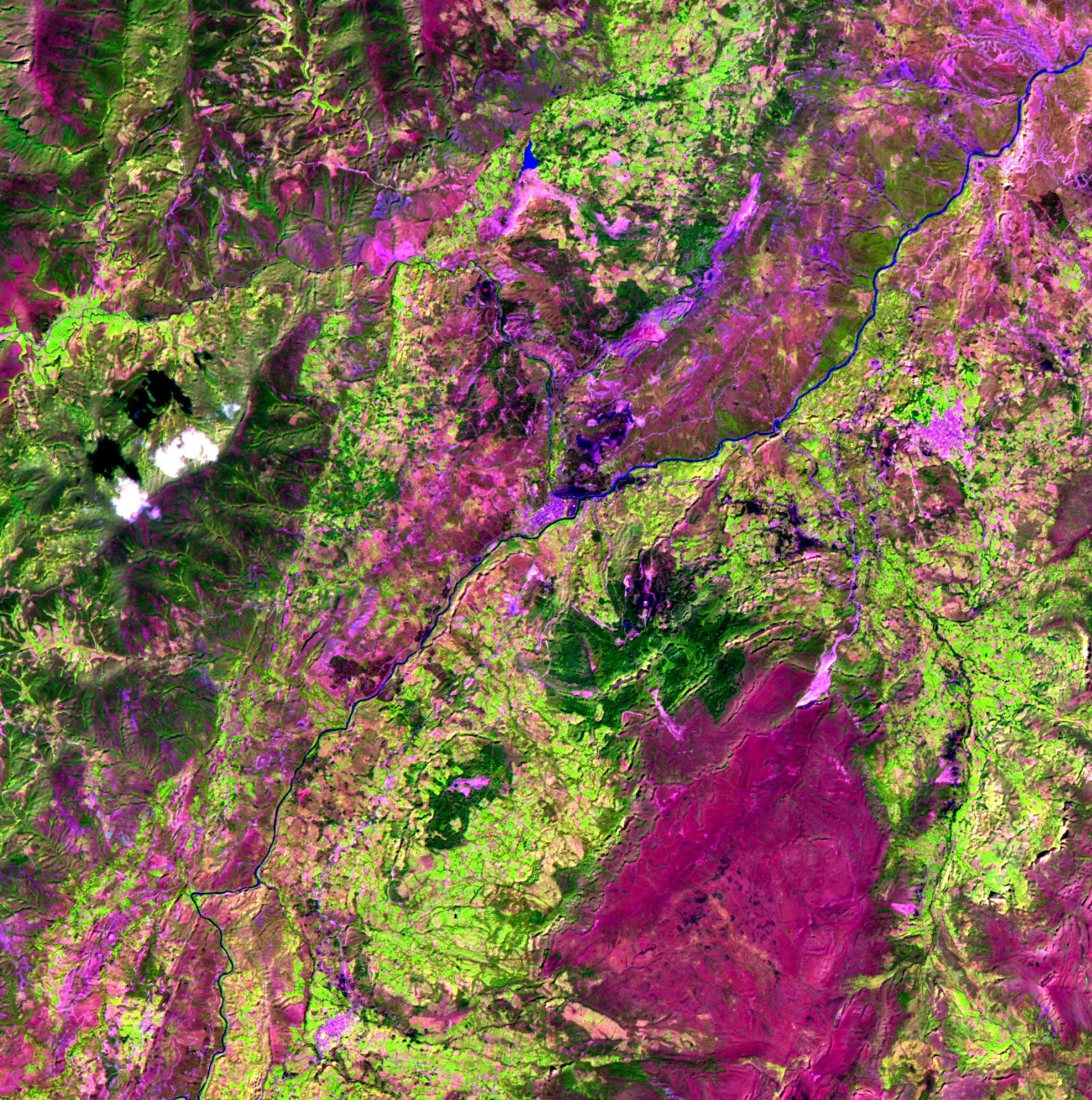
Iron and coal mining basin, Boyacá, Colombia · SWIR · NIR · Red · 12/15/2025 -
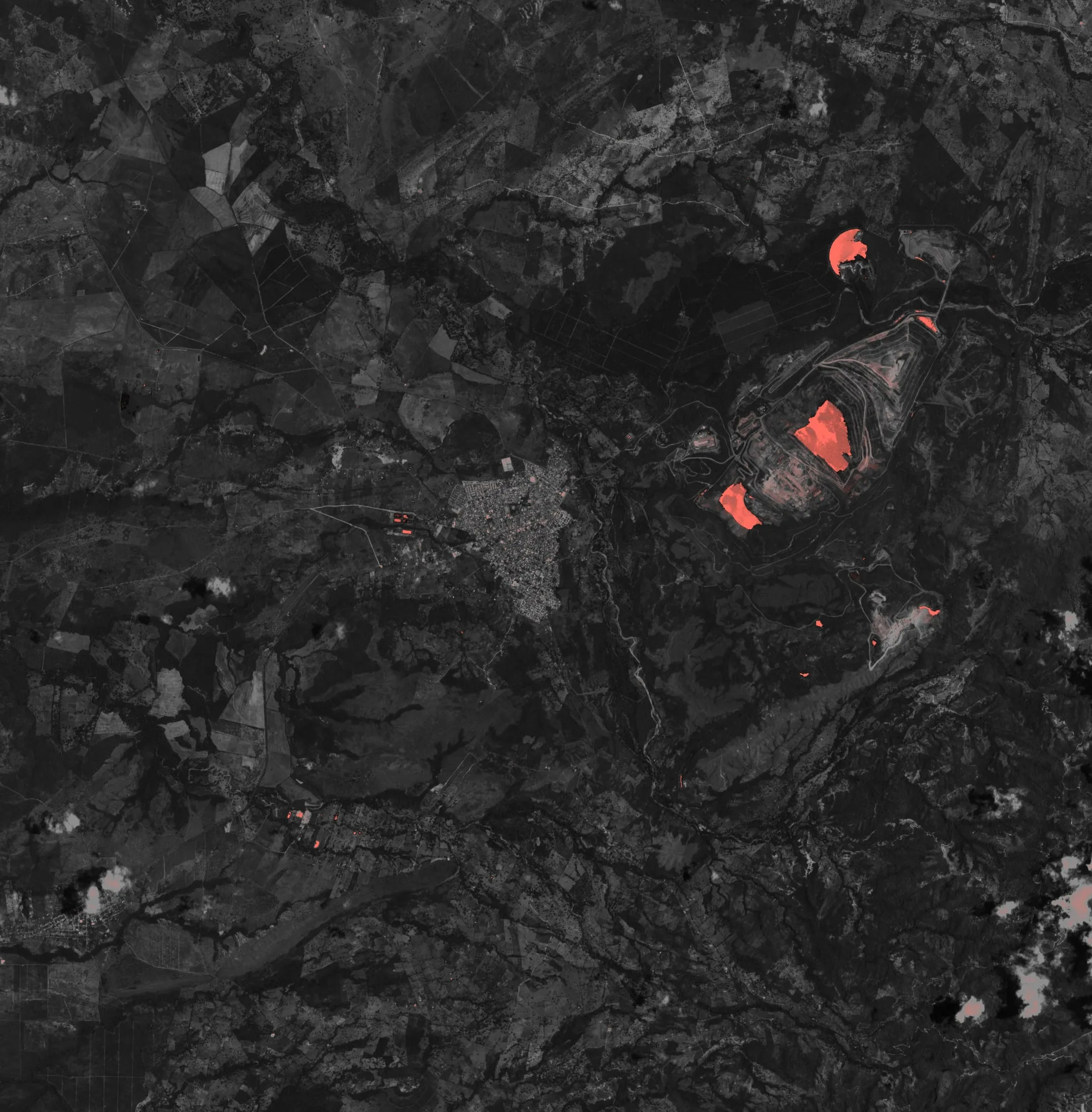
Open-pit coal, Cesar, Colombia · NDWI · water in coral · 08/25/2026 -
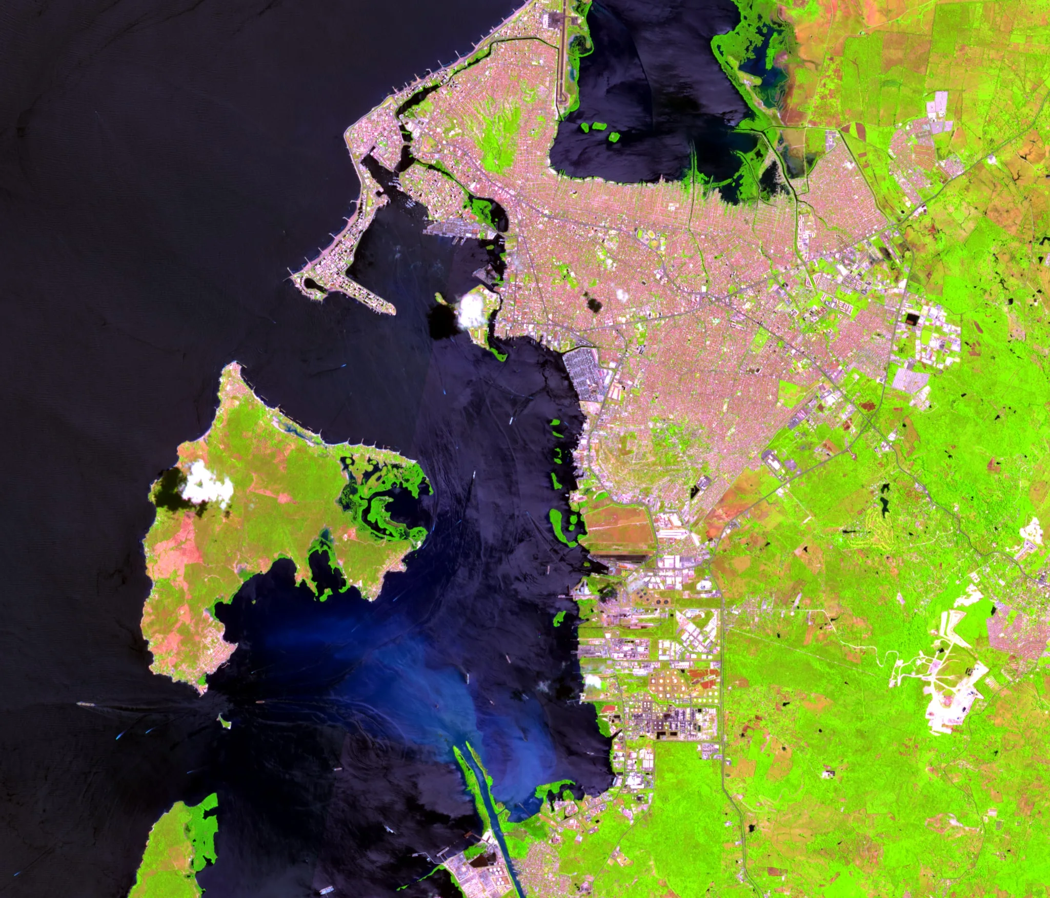
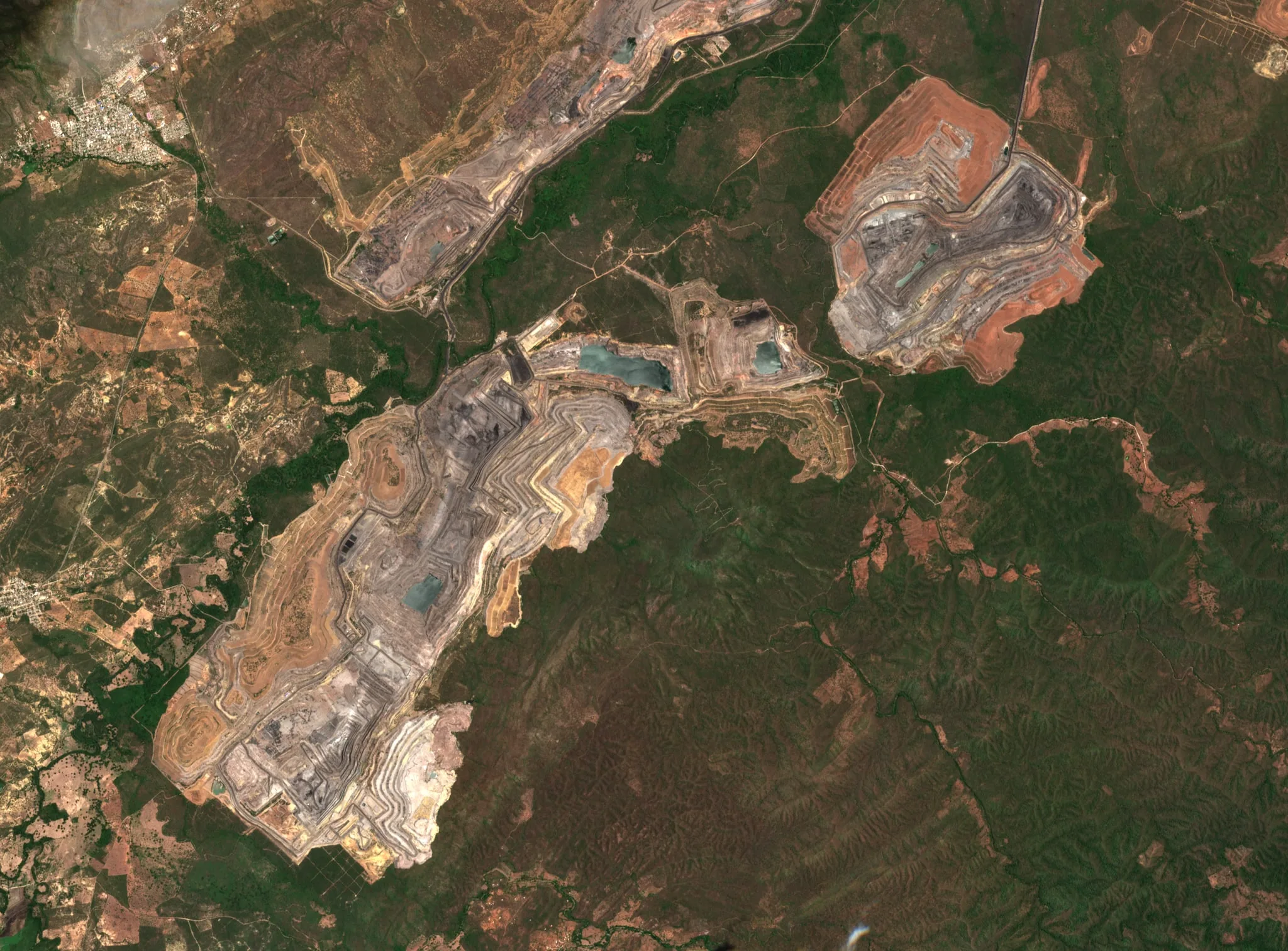
Cartagena Bay, Colombia · SWIR · NIR · Red · 07/29/2026


← Swipe to see the four scenes →
How it holds up
-
One model that centralizes sources
New sources enrich the variable catalog, always with the same structure.
-
It transfers across worlds
From ore grades, gas concentrations or electrical assets to satellite, aerial and maritime information.
-
It does not replace your systems
It feeds the ones already running and draws from them. It does not decide for the operator.
Inputs
Mining · Industrial operations
- WhatsApp: field reports: text, voice and photo
- Spreadsheets: HSE and production, versioned format
- Gas detectors: through the manufacturer's cloud
- Ventilation: and atmospheric monitoring
- SCADA and historians: edge gateway, publishes outwards only
- Fleet telemetry: ISO 15143-3 standard
- Partner deliverables: drone, survey, ROV
- Satellite imagery: open-pit operations
Defense · air and maritime · Mission
- Autonomous aerial systems: telemetry, position, mission status
- Electronic warfare and RF: system status, events, location
- Underwater vehicles: mission data, sonar, position, findings
- Cameras and sonar
- External sources: of information
Entities
- Site
- The operation: the mine, the unit, the base.
- Workplace
- Face, gallery, level or pit. In another vertical, an electrical asset or a pipeline section.
- Measurement
- A point reading of a variable, with capture time and ingest time.
- Variable
- What is measured and with which thresholds: gases, ventilation, geomechanics, electrical, grade.
- Finding
- An unsafe condition detected by a rule, an operator or a review.
- Action
- What was done about the finding: owner, deadline, evidence and closure.
- Source
- Where the data came from: system, ingest method, latency and reliability.
- Person
- Whoever captures or acts, with their role and shift.
- Shift
- The operating window in which all of the above happens.
Outputs
- Operation data · Mission data
- Consolidated per operation, with its traceability. Consolidated per mission, with its traceability.
- Common operational picture
- Position, status, alerts and findings from every system in a single view.
- Traceability
- Every data point with capture time, origin and owner.
- Analysis
- On the same traceable data, with its origin in plain sight.
- Alerts · owner · deadline
- Born from explicit, auditable rules.
- Exportable reports
- Fixed structure, exportable.
Mission & operational intelligence layer
One mission. Multiple systems. One operational layer.
Aeris integrates with the command and control, operations and management systems the institution or the operation already uses. It does not replace them: it feeds them and consumes information from them.
Principles
-
01
It integrates, it does not replace
It feeds and consumes the systems already in operation, without being tied to a single hardware manufacturer.
-
02
Assisted decision, human responsibility
Aeris does not decide for the operator and certifies nothing; it makes what matters visible and hard to ignore.
-
03
Traceable evidence
Origin, time and owner on every data point.
Bluberri works with a global network of partners.
Multiple industrial and defense capabilities to complement data collection and autonomous operations.
Capabilities
Capabilities that adapt to your operation.
-
From space
The whole site reviewed every week, with nobody sent to the field.
It cannot see under water or through clouds: it tells you which sector to go to.
Illustrative schematic
-
From the air
Channels, ponds and slopes photographed with coordinates and date, and compared with the previous visit.
The drone shows where the problem is; the laboratory confirms the quality.
Illustrative schematic
-
Under water and where nobody goes
Ponds, spillways and submerged pipes inspected without draining or exposing people.
We document what the responsible engineer needs in order to decide.
Illustrative schematic
-
With what the operation already measures
Flow meters, piezometers, gas, SCADA and laboratory on a single timeline.
It does not correct a bad measurement: it makes it visible in time.
Illustrative schematic
-
And it all ends in a decision
Every finding becomes a record with a rule, an owner, a deadline and proof of closure.
With all four, an alert is a decision that can be defended.
Illustrative schematic
No single source solves the problem. The difference is that all of them end up in the same record.
Process
How we work with you.
-
01
Structure
We turn an operational requirement into a solution architecture.
-
02
Integrate
We select and connect the technologies that requirement needs.
-
03
Deploy
We coordinate implementation, adaptation and interoperability in the field.
-
04
Evolve
We add new sources without rebuilding the architecture and hand the operation over.
How we start
From a short diagnosis to a pilot that gets measured.
-
01
Diagnosis
One or two flows, not the whole operation. Map aspect → control → signal → decision → evidence.
-
02
Pilot
A bounded set of critical controls in one unit. Baseline at the start, comparison at the end.
-
03
Operation
Service per unit or per working face, with the sources the site already has and the ones added.
-
04
Expansion
The periodic report and the inspection record come out of the platform; they are not assembled by hand.
Let's define the requirement. We structure the architecture.
Articles
What is happening in operations and across the industry.
Industry analysis and notes from the field on risk, inspection, regulation, uncrewed systems and the technologies that connect them.
-
The opportunity to orchestrate hardware in maritime and defense operations
One maker's ROV, another's drone, a third party's sensors. The opportunity is not better hardware: it is the layer that makes everything already operating speak the same language.- Cartagena
- Bogotá
-
35% of emergencies and 27% of fatalities: the cost of detecting late
Geomechanical failures account for 35% of emergencies and 27% of fatalities in underground mining. The difference often lies in the speed between signal and response.- Bogotá
- Tunja
-
What does downtime really cost?
The Boyacá strike left a figure: COP 6 billion per day. The question is whether your operation can put a number on each hour of downtime while it is happening.- Tunja
- Sogamoso
Frequently asked questions
Frequently asked questions.
What we are usually asked before people write to us.
01 What is Aeris?
Aeris is Bluberri's mission and operational intelligence layer. It connects to the systems, sensors and reports your operation or institution already produces and turns them into a single operational picture, with alerts, traceability, analysis and reports. It is not a drone, not a sensor and not management software: it is what connects them.
02 What is the shared data model?
It is the shared model of nine entities into which Aeris translates any incoming data: Site, Workplace, Measurement, Variable, Finding, Action, Source, Person and Shift. The model is permanent; the connectors to each system are replaceable. That is why an ore-grade measurement and a gas-concentration measurement share the same structure, and adding a new source changes the variable catalog and the connectors, not the schema.
03 Does Aeris replace our current systems?
No. Aeris integrates with the command and control systems, SCADA, historians, management software and field tools you already use. It feeds them and consumes information from them; your existing investments remain intact.
04 Which data sources can Aeris take in?
In mission: autonomous aerial systems, electronic warfare and RF spectrum, underwater vehicles, cameras, sonar and external sources. In industrial operations: WhatsApp reports, spreadsheets, connected gas detectors, ventilation systems, SCADA and historians, fleet telemetry, drone, survey and ROV deliverables, and satellite imagery. We hook in where the data is already structured.
05 What do you do with satellite imagery?
We treat it as one more source. We use open optical and radar imagery (Sentinel, NASA) as the baseline and hyperspectral observation delivered with partners under contract, with a revisit of up to twice a week, to review the whole site with nobody sent to the field: footprint changes, moisture where there should be none, vegetation under stress. The satellite does not replace the visit: it tells you which sector to go to. The images on this site are real Sentinel-2 scenes, with their sensor, date and coordinates in plain sight.
06 Are you tied to a hardware manufacturer?
No. Bluberri does not manufacture the hardware: it selects and connects the technologies each requirement needs. Changing platforms does not force you to rebuild the architecture.
07 How does a project start?
By defining the requirement. With it we structure the solution architecture, integrate the necessary technologies, deploy in the field and evolve the capability with you. In industrial operations, deployment starts with a bounded pilot on one asset or one set of critical controls, with a baseline and metrics agreed before anything is installed.
08 Where do you operate?
We start with mining operators and institutions in Colombia, with our team deployed on site.
09 Who decides, the AI or the people?
The people. Aeris alerts are born from explicit, auditable rules; every action has a human owner; Aeris does not certify the stability of a working area, nor does it replace the engineer, the HSE lead or the commander of the operation. It is a system of assisted decision and evidence.
10 Which Colombian regulations do you consider in mining?
The Safety Regulation for Underground Mining Works (Decree 1886 of 2015, as amended by Decree 944 of 2022), the Hygiene and Safety Regulation for Open-Pit Mining Works (Decree 539 of 2022), the Single Regulatory Decree 1072 of 2015, the Technical Guide for the Management of Mining Risks Caused by Geomechanical Failures (ANM, 2023) and the other guides of the Mine Safety and Rescue Group, and NTC 6620 on ground support plans. These instruments guide the rules and the reports; compliance remains the responsibility of the title holder.
11 What happens to our data?
The data belongs to the client. Hosting is defined in the scope of each project: on your infrastructure, on a dedicated server or in the cloud, according to the requirements of the operation or the institution.
12 Do you train operators?
Yes. Hands-on training for operators and technical teams, from using the system to deploying it in the field, is part of the capability we deliver.
13 How much does it cost?
Each project is sized according to the requirement and quoted with its scope. We do not publish prices for now.
Contact
Let's define your requirement.
Tell us what your operation or your mission needs. We reply with a scope proposal.